
Betunija
| Betunija arap. بيتونيا | |
|---|---|
| Administrativni podaci | |
| Država | |
| Teritorija | Palestinske teritorije |
| Stanovništvo | |
| Stanovništvo | |
| — | 19.761 (2.007) |
| Geografske karakteristike | |
| Koordinate | 31° 53′ 20″ S; 35° 10′ 03″ I / 31.8890° S; 35.1675° I |
| Površina | 26,2 km2 |
 Betunija Betunija na karti Palestinskih teritorija | |
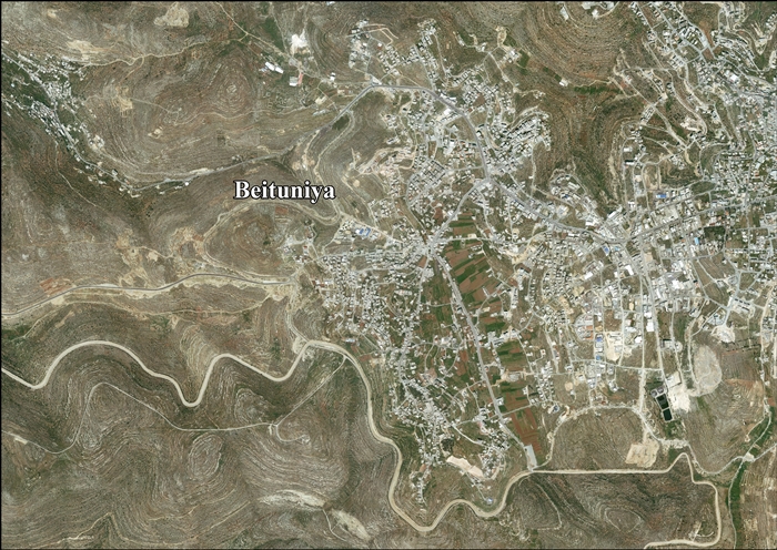
Betunija ili Bitunja (arap. بيتونيا), je grad u Palestini na Zapadnoj obali reke Jordan. Grad se nalazi 3 km zapadno od Ramale i 14 km severno od Jerusalima. Grad je deo guvernature Ramala i Al Bireh u centralnom delu Zapadne obale. Prema Palestinskom Državnom zavodu za statistiku grad je imao 19.761 stanovnika 2007,[1] što ga čini trećim po veličini gradom u guvernaturi posle Al Bireha i Ramale.
Istorija[uredi | uredi izvor]
Pronađene su krhotine keramike iz doba Vizantijskog carstva, ali i mamlučkog i ranog osmanskog perioda.[2]
Britanski Fond za Istraživanje Palestine (PEF) je 1883. sproveo Premer Zapadne Palestine, a na osnovu nalaza sugerisano je da je Betunija bila krstaško selo Uniet, koje je bilo jedno od 21 sela koje je kralj Gotfrid dao kao posed Crkvi Svetog Groba.[3] Međutim, 1887. godine, Rohriht je Betuniju identifikovao sa „Betiumenom”, drugim posedom koji je kralj dao Svetom grobu.[4][5] Konder utvrdio je da je ovo „očigledno tačno” i samim tim „veoma malo verovatno” da je Betunija bila „Uniet”.[6] Abel, pišući 1931. godine, je sugerisao da je Betunija bila „Bet Uniet”, pomenut u tekstu iz ranog 12. veka.[2]
Velika zasvođena zgrada u gradu, nazvana Bad al Balad (seoska presa za ulje) datirana je u doba krstaša.[7][8]
Doba Britanskog mandata nad Palestinom[uredi | uredi izvor]

U vreme popisa stanovništva u Palestini (1922) koji su sprovele vlasti britanskog mandata, Betunija je imala 948 stanovnika, od kojih su svi bili muslimani,[9] do sledećeg popisa stanovništva u Palestini (1931) taj broj je porastao na 1.213, i dalje su svi bili muslimani, koji su živeli u 277 domaćinstav.[10]
Prema statističkim podacima o selima Palestine, koje je prikupila vlada Britanskog mandata nad Palestinom (1945), populacija Betanije je dostigla broj od 1.490, a svi su bili muslimani,[11] dok je površina zemlje koja je pripadala selu bila 23.366 dunama, prema zvaničnom popisu zemljišta i stanovništva.[12] Za plantaže i zemljište koje je navodnjavano korišćeno je 7.854 dunuma, za žitarice 8.381,[13] dok je 77 dunuma bilo građevinsko zemljište (pod kućama).[14]
Jordansko doba[uredi | uredi izvor]
U jeku Arapsko-izraelskog rata 1948. i nakon sporazuma o prekidu vatre 1949, Betunija je bila pod kontrolom Jordana, koji je ubrzo anektirao Zapadnu obalu reke Jordan 1950.
Betunija je 1961. imala 2.216 stanovnika.[15]
Izraelska okupacija[uredi | uredi izvor]
Betunija je 1967. nakon 19 godina jordanske vlasti i Arapsko-izraelskog rata 1967. prešla u ruke Izraela. Nakon 1995. godine, prema Sporazumu iz Osla, 3.759 dunuma (17,8%) gradske zemlje je klasifikovano kao sektor A, 472 dunuma (2,2%) je klasifikovano kao sektor B, dok su preostalih 16.896 dunuma (80%) klasifikovani kao sektor C. Izrael je konfiskovao deo zemlje koji je pripadao Betuniji kako bi sagradio dva izraelska naselja: Bet Horon i Givat Zeev.[16][17]
Prema Sporazumu iz Osla, Izraelske odbrambene snage nemaju pravo da uđu u područja A (područje pod potpunom kontrolom Palestinske samouprave), ali je nakon „operacije odbrambeni štit” 2002. različiti položaj sektora je ukinut kada je izraelska vojska te godine ušla u Betuniju u potrazi za osumnjičenim, koji je hteo da izvrši teroristički napad.[18]
Savremeno doba[uredi | uredi izvor]
Zbog loše ekonomske situacije u gradu, mnogi su emigrirali. Neki su otišli u područje Čikaga i bili uključeni u pokretanje fondacije Bridžvju džamija.[19][20]
Reference[uredi | uredi izvor]
- ^ 2007 PCBS Census. Palestinian Central Bureau of Statistics. pp. 114.
- ^ a b Finkelstein et al, 1997, pp. 346-7
- ^ Conder & Kitchener 1883, SWP III, p. 11
- ^ Röhricht, 1887, p. 205
- ^ de Roziére, 1849, pp. 98, 102: Beituimen; both cited in Röhricht, 1893, RRH, pp. 16- 17, No 74
- ^ Conder, 1890, pp. 30, 32
- ^ Pringle, 1997, p. 29
- ^ Pringle, 2009, pp. 235-240
- ^ Barron, 1923, Table VII, Sub-district of Ramallah, p. 16
- ^ Mills, 1932, p. 48.
- ^ Government of Palestine, Department of Statistics, 1945, p. 26
- ^ Government of Palestine, Department of Statistics. Village Statistics, April, 1945. Quoted in Hadawi, 1970, p. 64
- ^ Government of Palestine, Department of Statistics. Village Statistics, April, 1945. Quoted in Hadawi, 1970, p. 111
- ^ Government of Palestine, Department of Statistics. Village Statistics, April, 1945. Quoted in Hadawi, 1970, p. 161
- ^ Government of Jordan, Department of Statistics, 1964, p. 15
- ^ Betunia: A Palestinian Community, POICA
- ^ Beituniya Town Profile, ARIJ, pp. 17-18
- ^ Nahum Barnea, 'Beitunian nights: The IDF in the West Bank', Ynet 18 March 2016.
- ^ Hard-liners won battle for Bridgeview mosque, February 8, 2004 Chicago Tribune
- ^ Forget Poles: Palestinians find a home in suburban Chicago Arhivirano na sajtu Wayback Machine (5. februar 2016), February 7, 2013, webz.org
Literatura[uredi | uredi izvor]
- Barron, J.B., ur. (1923). Palestine: Report and General Abstracts of the Census of 1922. Government of Palestine.
- Conder, C.R.; Kitchener, H.H. (1883). The Survey of Western Palestine: Memoirs of the Topography, Orography, Hydrography, and Archaeology. 3. London: Committee of the Palestine Exploration Fund.
- Conder, C.R. (1890). „Norman Palestine”. Quarterly statement - Palestine Exploration Fund. 22: 29—37.
- Ellenblum, Ronnie (2003). Frankish Rural Settlement in the Latin Kingdom of Jerusalem. Cambridge University Press. ISBN 9780521521871. (pp. 73, 185)
- Finkelstein, I.; Lederman, Zvi, ur. (1997). Highlands of many cultures. Tel Aviv: Institute of Archaeology of Tel Aviv University Publications Section. ISBN 965-440-007-3.
- Government of Jordan, Department of Statistics (1964). First Census of Population and Housing. Volume I: Final Tables; General Characteristics of the Population (PDF).
- Government of Palestine, Department of Statistics (1945). Village Statistics, April, 1945.
- Guérin, V. (1875). Description Géographique Historique et Archéologique de la Palestine (na jeziku: French). 2: Samarie, pt. 2. Paris: L'Imprimerie Nationale.
- Hadawi, S. (1970). Village Statistics of 1945: A Classification of Land and Area ownership in Palestine. Palestine Liberation Organization Research Centre.
- Hartmann, M. (1883). „Die Ortschaftenliste des Liwa Jerusalem in dem türkischen Staatskalender für Syrien auf das Jahr 1288 der Flucht (1871)”. Zeitschrift des Deutschen Palästina-Vereins. 6: 102—149.
- Hütteroth, Wolf-Dieter; Abdulfattah, Kamal (1977). Historical Geography of Palestine, Transjordan and Southern Syria in the Late 16th Century. Erlanger Geographische Arbeiten, Sonderband 5. Erlangen, Germany: Vorstand der Fränkischen Geographischen Gesellschaft. ISBN 3-920405-41-2.
- Mills, E., ur. (1932). Census of Palestine 1931. Population of Villages, Towns and Administrative Areas. Jerusalem: Government of Palestine.
- Palmer, E.H. (1881). The Survey of Western Palestine: Arabic and English Name Lists Collected During the Survey by Lieutenants Conder and Kitchener, R. E. Transliterated and Explained by E.H. Palmer. Committee of the Palestine Exploration Fund.
- Pococke, R. (1745). A description of the East, and some other countries. 2. London: Printed for the author, by W. Bowyer.
- Pringle, Denys (1997). Secular buildings in the Crusader Kingdom of Jerusalem: an archaeological Gazetter. Cambridge University Press. ISBN 0521 46010 7.
- Pringle, Denys (2009). The Churches of the Crusader Kingdom of Jerusalem: Volume IV The cities of Acre and Tyre with Addenda and Corrigenda to Volumes I-III. Cambridge University Press. ISBN 978-0-521-85148-0.
- Robinson, E.; Smith, E. (1841). Biblical Researches in Palestine, Mount Sinai and Arabia Petraea: A Journal of Travels in the year 1838. 2. Boston: Crocker & Brewster.
- Robinson, E.; Smith, E. (1841). Biblical Researches in Palestine, Mount Sinai and Arabia Petraea: A Journal of Travels in the year 1838. 3. Boston: Crocker & Brewster.
- Röhricht, R. (1887). „Studien zur mittelalterlichen Geographie und Topographie Syriens”. Zeitschrift des Deutschen Palästina-Vereins. 10: 195—344.
- Röhricht, R. (1893). (RRH) Regesta regni Hierosolymitani (MXCVII-MCCXCI) (na jeziku: Latin). Berlin: Libraria Academica Wageriana.
- de Roziére, ur. (1849). Cartulaire de l'église du Saint Sépulchre de Jérusalem: publié d'après les manuscrits du Vatican (na jeziku: Latin i French). Paris: Imprimerie nationale.
- Schick, C. (1896). „Zur Einwohnerzahl des Bezirks Jerusalem”. Zeitschrift des Deutschen Palästina-Vereins. 19: 120—127.
- Sharon, M. (1999). Corpus Inscriptionum Arabicarum Palaestinae, B-C. II. BRILL. ISBN 9004110836.
- Socin, A. (1879). „Alphabetisches Verzeichniss von Ortschaften des Paschalik Jerusalem”. Zeitschrift des Deutschen Palästina-Vereins. 2: 135—163.
Spoljašnje veze[uredi | uredi izvor]
- Welcome To Beituniya
- Beitunia, Welcome to Palestine
- Survey of Western Palestine, Map 17: IAA, Wikimedia commons
- Beituniya Town (Fact Sheet), Applied Research Institute–Jerusalem (ARIJ)
- Beituniya Town Profile, (ARIJ)
- Beituniya, aerial photo, (ARIJ)
- Civil Administration nixes order to take land for settlement road, June 14, 2012, The Times of Israel
| Međunarodne | |
|---|---|
| Državne | |